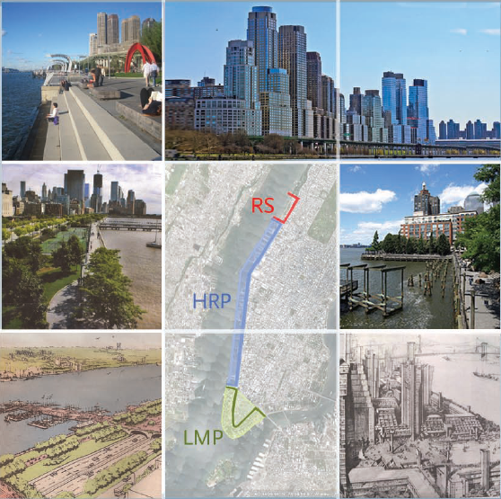
In the space of fifty years, Manhattan's Hudson River waterfront has been transformed on a scale and timetable almost without precedent. After three centuries as America's premier port and rail hub, this entire four-mile stretch (from the Battery to 72nd Street), has become a
stunning model of high-density urban communities—offices, retail and residential life—set in a lively sequence of parks, promenades, and playgrounds.
Having been born and raised in Manhattan, and practicing as an Architect and Planner there
since 1960, it was thus my great privilege to have participated in several of the transformative initiatives that gave birth to this new waterfront. I wish here to give a brief account of several of these seminal events.
The Lower Manhattan Plan of 1966 (with Bill Conklin and Jim Rossant), which set the scale and agenda for two generations of design and construction to come.
River Road of 1980 (with John Belle), the proposal for a linear park (and Boulevard) on the West Side that eventually became the Hudson River Park.
Riverside South of 1990 (with Dan Gutman), the plan for thirteen blocks of Hudson waterfront (from 59th to 72nd Streets) consisting of a new riverside park and a grand curving boulevard of
apartment buildings looking out on the park and the grand Hudson beyond.