|
CONCEPT
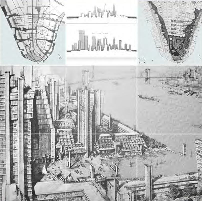
An upgrade of the rich cluster of mass transit lines and stations, as well as the outdated peripheral highways, were also to be part of this new mix.
The central idea that emerged was to organize the waterfront communities (each of 10,000-15,000 people) around outward extensions of lower Manhattan's unique canyon-streets (Chambers, Wall, Rector, Broad, Fulton), linking the old city to the new. Conceived as a "necklace of neighborhoods," these nodes were composed of low, terraced structures interspersed with tall towers and residential courtyards.
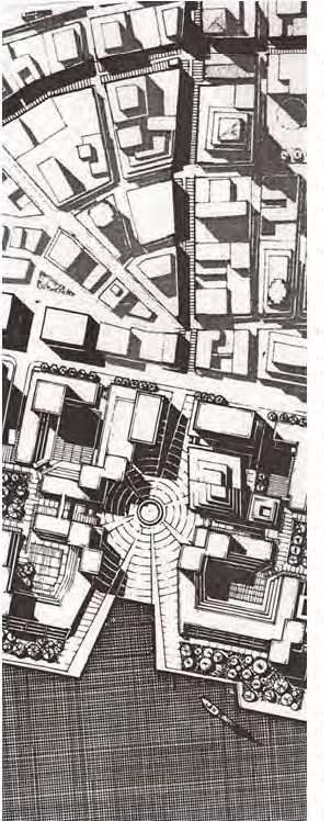
River Plazas
Each defining street culminated in a plaza—an opening to the waterfront—widening as it approached the river. To reinforce the link to the river, deep coves were planned at the water's edge. The plazas themselves were linked by a continuous promenade.
This dramatic confluence of forces was illustrated in the widely-published aerial rendering by James Rossant (right.) Its vision of the waterfront would inspire future planners and architects, setting the scale and agenda for the new waterfront.
|